

Valgrisenche: little Alaska
Our Heliski Valgrisenche trails
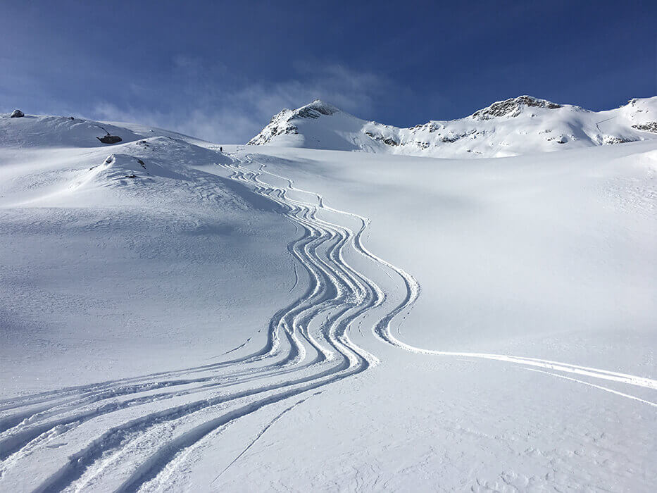
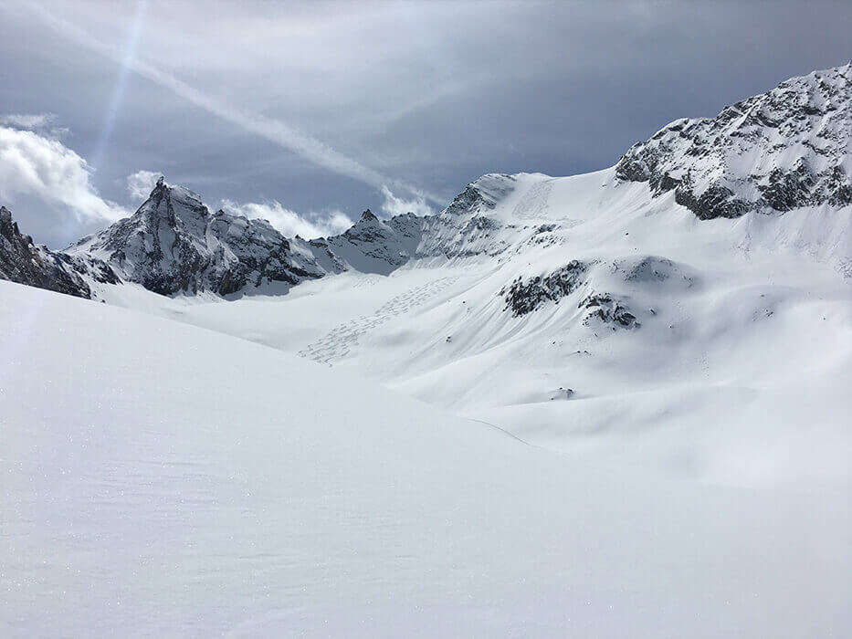
It has been called “little Alaska” and it is an absolute paradise for heliskiing and ski-mountaineering. It is a very long and picturesque valley: you can ski on both sides and the snow conditions are excellent until the end of the season.
The heliski meeting place is in Bonne, at Hotel Perret, where you can have breakfast and dinner at the end of the day and – why not? – even sleep if you plan on having a few days or want to arrive the evening before.
The valley has about fifty helicopter drop-off points, which makes it very flexible according to weather and snow conditions: the vast area allows you to identify the slopes that offer least risk of avalanche, so you can ski in the greatest possible safety.
Valgrisenche is famous throughout the world for the quality of its fresh snow, which even lasts a few days after snowfall. It is a valley with little wind, the helicopter flies more often here than in other places (such as Cervinia) and the snow conditions last a long time, reducing the risk of finding the reviled “slabs”.
Another distinction is that although you reach high altitude of 3300/3400 metres, there are no glaciers, which makes the descent less dangerous due to the absence of crevasses.
There are several runs of more than 1000 metres of altitude difference, lengths that entail at least 45 minutes of skiing, but in the middle of the winter season there are some with more than 1200 metres difference, and up to 1800 metres for the Becca di Tos in Chamencon: this way not only can you ski longer, but you can also reduce the cost of the helicopter.
Some advice? Decide how many runs you want to make and then make your arrangements on the basis of the conditions in the morning (for safety reasons, not all drop-off points are operational all the time, so you could find some descents are inaccessible). If you can, take a “panoramic” flight: leave from one side of the valley and ask to be brought to a peak on the other side, far enough away so that you have time to observe from above and decide where you want to ski.
Chateau Blanc lakes
Starting altitude: 3300m
Difference in altitude: 850m
Difficulty: easy
Return: helicopter
This descent is often the debut of the day in Valgrisenche, it is very safe, well exposed to the south, and has a spectacular view. The drop-off at 3300m in altitude is right under the Ruitor in a gorgeous, very open amphitheatre, from which you can see the lower valley and the most famous over-4000m peaks: the Matterhorn, Monte Rosa and Gran Paradiso.
The descent takes place on broad, not particularly steep ‘panettoni’ or extensions that allow you to ski fluently and settle into skiing for the day. The absence of overly steep sections and channels makes this one of the safest runs, even when it has snowed heavily.
The pick-up, at 2400m, takes place in an area called ‘laghi’ or lakes: a basin in which you are surrounded by nature and the only sound you hear is that of the helicopter arriving and departing.
It is definitely an easy, undemanding descent. The only drawback is that it ends too soon, because it isn’t very long, but it is definitely the ideal way to begin.
In the first part, the slope is gentle: perfect for taking videos and photos. The breadth of the area and the landscape allow you to create wonderful images, almost a 360° wraparound sensation. So it is, too, in the intermediate part, where the broad ‘panettoni’ are perfect for classic parallel-skiing videos.
You will have one of the finest memories of this downhill every time you are driving towards Mont Blanc after Aosta: look to your left and you will see an all-white mountain with a white ‘panettone’ and you will say: “that is Chateaublanc lakes”.
Chateau Blanc Planaval
Starting altitude: 3300m
Difference in altitude: 1500m
Difficulty: average
Return: car
This is one of the longest and most satisfying runs, not least because it is very varied. The high-altitude drop-off is below Chateau Blanc, after the first plateau; you will land on the right (to avoid going to the “lakes” variant) faced with a wonderful view of Aosta and the group of Monte Rosa and the Matterhorn.
There are some exciting walls in the first part, and above all, there is a degree of exposure that makes it possible to find beautiful snow even late in the season: it holds very well on the sides because it is well protected from the wind and the sun. If you like counter-slope and edge skiing, you will find plenty to keep you happy here.
In the second part there are some nice walls and then the woods begin, though they are not particularly dense and so skiable, in which the conditions are usually well preserved.
At the bottom, you will have to use your poles and push for five minutes, and remove your skis a couple of times to cross the road to reach the car park: here you can decide whether to eat at the restaurant in Planaval or return to the Bonne base, having the minivan come to pick you up.
It is a splendid, long and satisfying run that is often skied at the end of the day. The difference in altitude is almost 2000 metres. In the lower part, thanks also to the altitude, you may find snow that is a bit soft. But I assure you that overall it is one of the most beautiful.
Giasson
Starting altitude: 3300m
Difference in altitude: 1500m
Difficulty: average
Return: helicopter
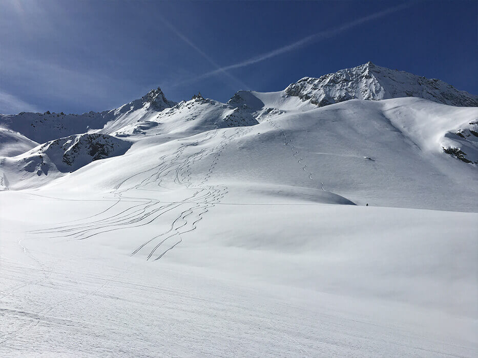
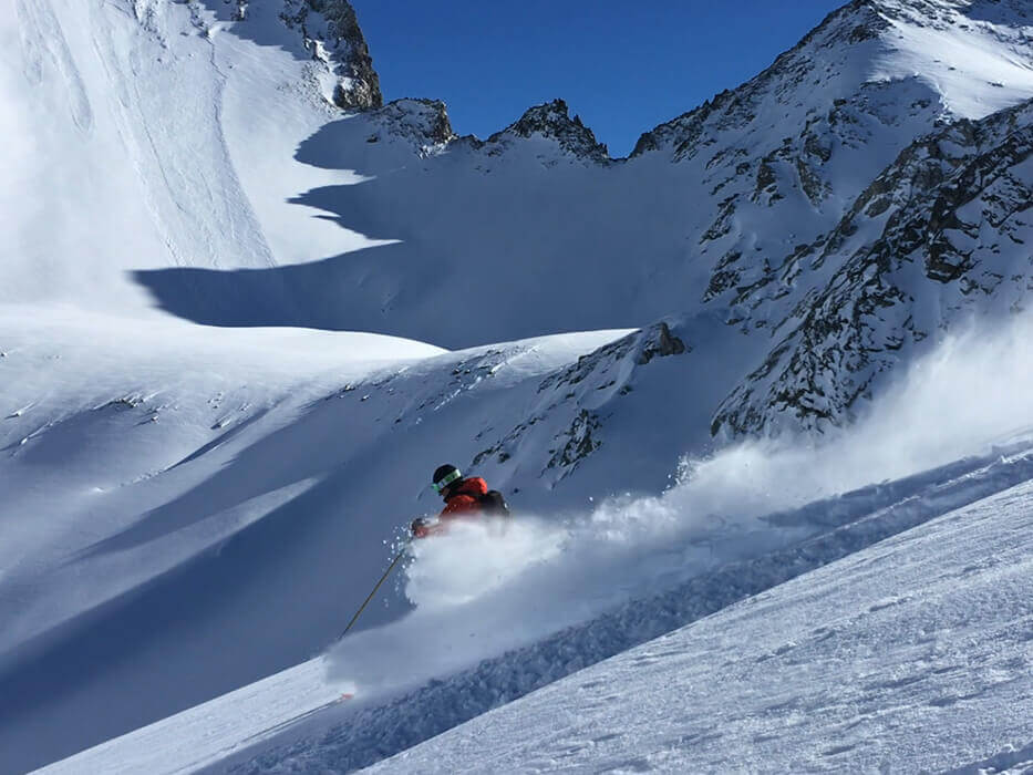
One of the most famous runs in Valgrisenche, Giasson is also one of the most picturesque, and definitely enormously satisfying, because it maintains powder snow until late-season, and has great variety in its slopes.
The drop-off is beneath Becca di Giasson at 3200 metres in altitude. The beauty of this descent is that it alternates fairly steep walls with gentler sections, thus breaking up the rhythm and giving a sensation of great length. There are also a couple of variants in the second part, so you can even repeat the run.
The first wall, on the left as you go down, is spectacular and perfect for photos and videos, especially shooting from beneath. Then there are some flattish parts where you can seek out the slope and exposure that you like the most.
After the long traverse, you will meet another wall with a few little trees and the first cabins, which are few, and spread far apart from each other, and probably half buried under the snow. Then you will approach the line of the pines with other easy slopes. Don’t forget to turn around now and then to take in the panorama, which in this basin is marvellous and enveloping.
If the conditions allow, it is nice to pass through the woods and on to the little bridge, from where you can reach the pick-up point in Usellieres, which is preceded by an open slope on which you can carve your last turns fluently and in great relaxation.
The only snag with this descent is that because it is so beautiful, it is also very popular with ski-mountaineers and heliskiers and it may happen that you find some slopes already quite marked. For this reason, I suggest you do it as you first run; and in any case if it has not snowed for a long time, I would opt for another, perhaps less famous piste on the same side. Once in your life, though, you have to try it.
Ormelune
Starting altitude: 3100m
Difference in altitude: 900m
Difficulty: average
Return: helicopter
This is a little-known and charming descent. The drop-off provides a view of Mont Blanc and the Ruitor from a different angle. The descent is not difficult and is mainly exposed to the east: it is better to do this run in the morning and, like all the slopes on this side of the valley, it suffers the heat and the passing of the winter months.
However, they are entertaining slopes and they let you ski in complete tranquillity. You will alternate steeper and flatter sections. This part of the valley is full of boulders and, if you visit when there is no snow, it gives you the feeling of being in a lunar, decidedly uninhabited landscape.
The slopes are not demanding: with a bit of luck, you might find powder in the upper part, especially on the exposed counterslopes, which get less sun in the morning.
In late season, the final part of the downhill has transformed snow, where you can ski and make some nice videos. The last stretch is very flat, go crazy with the photos: they will make a wonderful souvenir!
If the conditions allow, you can try to get down to Usellieres along the road, otherwise you will be picked up before the big Alpine pasture in a large, open area where the helicopter can land safely.
It is a lovely run to start the day as an alternative to Chateau Blanc, before moving over to the north side of the valley.
Fos
Starting altitude: 3200m
Difference in altitude: 1400m
Difficulty: average; upper part is difficult
Return: helicopter
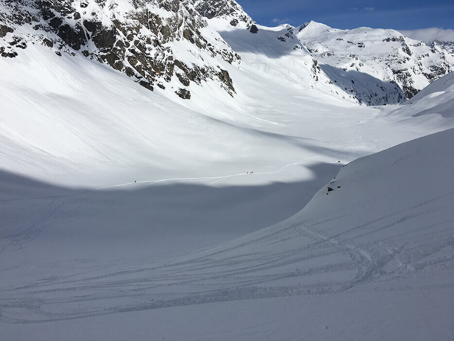
Snow conditions do not often allow you to ski this gorgeous descent, which is located a short distance from Giasson. The drop-off is spectacular, because it is a saddle between two slightly higher rocky peaks and makes you feel a little boxed in. Looking west you see the Vanoise and the whole Val di Rhemes, as well as the Gran Paradiso group, while in front of you is Mont Blanc and on your right, all of Valgrisenche.
.
The slope is exposed to the north. Spectacular and steep, it often has fresh snow, even late in the season. The gradient is fairly constant and not overly steep.
Some stretches are very long and in counterslope. In the final part, the slope merges at Giasson, which is slightly further west. If there is snow, you should make it to Usellieres passing through the woods for your pick-up, but if you do it in April, when the snow is more stable, in all likelihood you will be picked up at the cabins just before the woods.
If the conditions are right, it is a truly unforgettable and spectacular run, challenging to the right degree. It could be a descent for a day when you decide to do only two.
Becca di Tos
Starting altitude: 3300m
Difference in altitude: 1900m
Difficulty: average
Return: helicopter – car
It is the first run on your left that greets you as you drive up into Valgrisenche (not to be confused with the almost-homonymous Fos): a classic north-facing piste that almost always has winter snow, even late into the season. The high-altitude drop-off can be right at the Becca or just below, depending on the conditions: above, you are right on top of Val di Rhemes and facing Valle d’Aosta.
They are not easy slopes, because after an initial plateau on which you ski effortlessly, a very steep, long wall begins in a decidedly Alpine context. The sun doesn’t shine much in this channel and the snow is soft, with the exception of the initial stretch, which is narrow. Once past this brief bottleneck, it is nice to descend moving towards your right, trying to lose as little altitude as possible, and identify the line of the greatest slope to carve a few turns.
Having finished the upper part, there is a not-overly-dense woods, which makes a very picturesque setting for a few photos: you can stand with the channel behind you and manage to crystallise all the upper part of this splendid slope with one picture. Then you have to traverse a little valley and the bed of a summer stream to get to the chalets. If there is no snow, the helicopter will come to pick you up here; otherwise, if the conditions allow, you can reach the hamlet of Chamencon more than 500 metres further down. The first part of the woods, however, is quite dense and difficult to ski in, but the final part that leads you to the village is very beautiful and gives you almost 2000 metres of altitude difference, a long and in many ways unforgettable descent. If you prefer not to go through the woods, in the upper part after the cabins, follow the snow-covered carriageway. Then a minivan will take you back to Bonne – it’s about a 20-minute drive – and as you drive some of the way back up into Valgrisenche, you will have the direct perception of how far down you have come.

Felumaz
Starting altitude: 3000m
Difference in altitude: 1200m
Difficulty: average
Return: car
This slope on the north side of the mountain owes its success to the fact that it is often used as a final rotation, when it is not possible to return to Bonne from the southern side of the valley.
The slopes and the layout of the mountain are similar to the other descents on the north side of Valgrisenche. However, this is quite a popular run with heliskiers and you may risk finding many more tracks than there were on other slopes you skied that day.
The high-altitude drop-off is in a very broad patch of land that offers a view of the valley and an opportunity for some nice photos. The run is fairly straightforward: the first part has the classic not-very-steep panettoni that you can ski effortlessly on. Then there is a channel, which widens out after about fifty metres, like an inverted funnel.
The last stretch is in the woods, like all the slopes on this side: you can ski comfortably and often the lack of sunlight preserves conditions that will provide fun to the last curve.
The descent ends in a wide plateau, often with compacted though quite skiable snow and in the sun, then there is a little bridge where you have to walk for a few dozen metres before returning to Bonne by car. In the meantime you can take a stroll through the village of Valgrisenche: the traditional local products are outstanding.
Wind up the day at Pierret restaurant, at a table by the window if possible. In front, you will see where you have finished your day, and feature in your own little mountain tableau.
Rabuigne (upper/lower)
Starting altitude: 3400m
Difference in altitude: 1600m A – 1300m B
Difficulty: average, upper part is difficult
Return: helicopter
One of the most beautiful downhills in Valgrisenche, Rabuigne is mainly exposed to the north, where you can find powdery snow until the end of the season, in May.
If conditions permit, you will be dropped off on the hill, at 3400m in altitude, where a rather steep but immensely satisfying slope begins. Otherwise you will be dropped off at about 3000m on a rather small landing patch.
After a short traverse, a long valley opens so you can ski in great freedom and tranquillity and take fantastic photos. The slopes are broad and not too steep, and in the background looms the magnificent Becca di Tei.
At the bottom you keep to the left and ski along a gentle slope, until the gradient changes again with a spectacular wall.
The slope then levels off a bit until the area of Chalet de l’Epée, easy skiing with wonderful views.
If there is snow, you can continue to ski down to 1800m; the first part is in the woods, which you can cut through, or follow the road down to the bridge.
At the end of the woods, the last stretches open out with an enjoyable gradient. Seek out the places with fewer tracks: the snow often holds well to the left at the bottom or in the woods to the right along the stream in late season. You will find the helicopter at the pick-up point in Usellieres, where several downhills converge.
From Bonne and also from the window behind the counter of Hotel Pierret, if you look up to the right you will see the wall of the upper part of Rabuigne and thus crystallise the image in your eyes forever!
Rabuigne and Becca di Tos are two descents that make an unforgettable day.
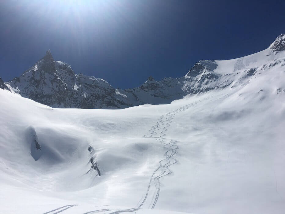
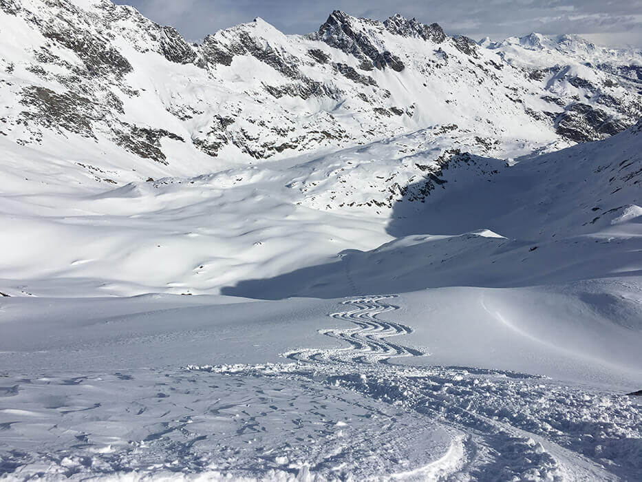
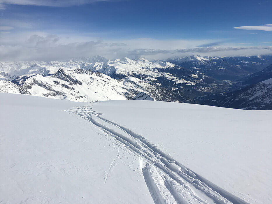
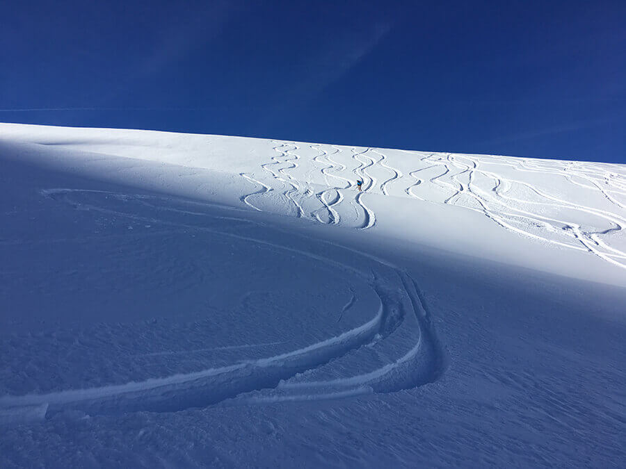
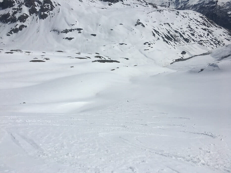
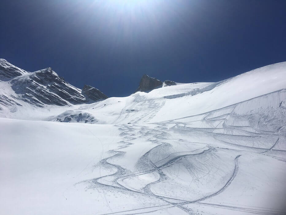
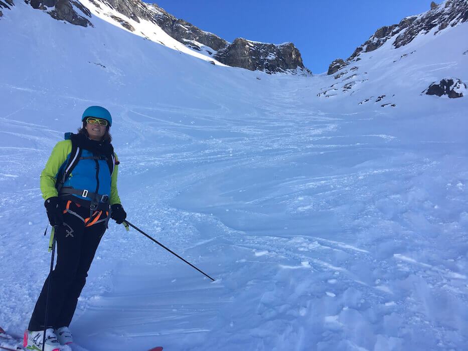
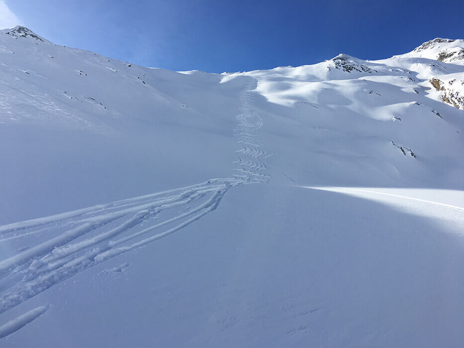
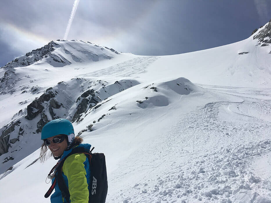
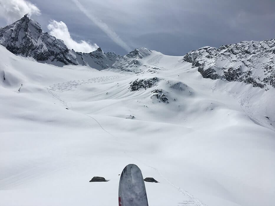
Some photos of the routes in Valgrisenche
Recap of Valgrisenche Heliski trails
| Name | Altitude difference | Glacier | Difficulty | Tweet judgement | Return/Pick-up |
|---|---|---|---|---|---|
| Giasson 3300m | 1500 m (less 400m to cabins) | NO | Average | One of the most famous descents, rightly, in Valgrisenche, a must for heliskiers, almost always with excellent powder conditions. | Usellieres. Helicopter Cabins at 2200m Helicopter |
| Rabuigne Upper and Lower 3400m | 1600 m A 1300 m B Less 500 if Epée | NO | Average Upper part is difficult | My favourite downhill, especially with the drop-off in high altitude. Panoramas, slopes, great powder and a picture with Becca di Tei in the background is “the photo”. | Usellieres Helicopter
Chalet de l’ Epée at 2370m Helicopter |
| Cime di Fos 3200m | 1400 m Less 500 if Epée | NO | Average Upper part is difficult | With the right conditions, can be the descent of the year for the snow quality, slope and high-altitude panorama. Be careful of avalanches. | Usellieres Helicopter
Chalet de l’ Epée at 2370m Helicopter |
| Becca di Tos 3300m | 1900m Less 600 if pick-up with helicopter | NO | Average | Unforgettable altitude difference, almost 2000 metres, great channel and slopes. Even the woods, first sparse then dense, appeals on this run. | High-altitude cabins Helicopter
Chamencon, by car and return to Bonne (20 min) |
| Felumaz 3000m | 1200m | NO | Average | A fine, undemanding descent with a lovely panorama, ideal for closing the day if you can’t get back from the southern slopes. | Valgrisenche, by car and return to Bonne (5 min) |
| Ormelune 3100m | 900m | NO | Average | Ideal as a relaxing start to the day, nice slope at the top and relaxing plateaus at the end, which transform quite quickly. | Valle di Suzey Helicopter |
| Chateaublanc Lakes 3300m | 850m | NO | Easy | The drop-off offers a unique panorama, which you see every time you pass by Aosta. This is a very safe descent and ideal for starting the day. | Lakes Helicopter |
| Chateaublanc Planaval 3300m | 1500 m | NO | Average | A descent that seems to go on forever: have fun at the start with counterslopes and at the end with the walls. | Planaval, return to Bonne by car (10/15 min) |
| Gliairetta 3100m | 800 m | NO | Average | The drop-off at the bottom of the valley guarantees spectacular views and not too demanding slopes, ideal when it has snowed a lot. | In the large valley beneath Grande Sassiere 2300m. Helicopter |
| Colle Traversiere 3100m | 850 m | NO | Easy | Spectacular panorama from the valley floor, almost in France; an easy, open run with long plateaus leading to the Bezzi refuge. If you like relaxed skiing, this is the downhill for you. | Bezzi refuge 2284m Helicopter |
| Ruitor 3200m | 1300 m | NO | Average | Less famous than the south slope on Lathuile, a fine descent of average difficulty exposed to the south, ideal for skiing back to the restaurant in Bonne. | Bonne, arriving right at the restaurant!
🙂 |