

Cervinia: a natural amphitheatre
Our paths of Heliski Cervinia
In all likelihood, heliskiing started in Italy under the Matterhorn. It is said that wealthy people from Turin often came to the area in their private aircraft. One of these was the Fiat mogul, Mr Agnelli, who liked to pop over to La Chateau des Dames, a beloved Sunday morning destination before going to the stadium to watch his team play. Since then, the sector has been regulated and the descents are much more accessible, but the milieu remains unique and is definitely one of the best for heliskiing.
The great advantage of Cervinia, which you can reach by car in two hours from Milan, is the starting altitude: 2000 metres. This guarantees that there is always snow and that the season lasts even until the beginning of May. Many drop-off points are over 3500m and can reach almost 4200m with Silbersattel (Monte Rosa).
The choice of exposures, difficulties, and altitude differences is ample, but what really makes Cervinia a unique destination is the scenery: Monte Rosa and the Matterhorn are set in a natural amphitheatre that attracts tourists from all over the world.
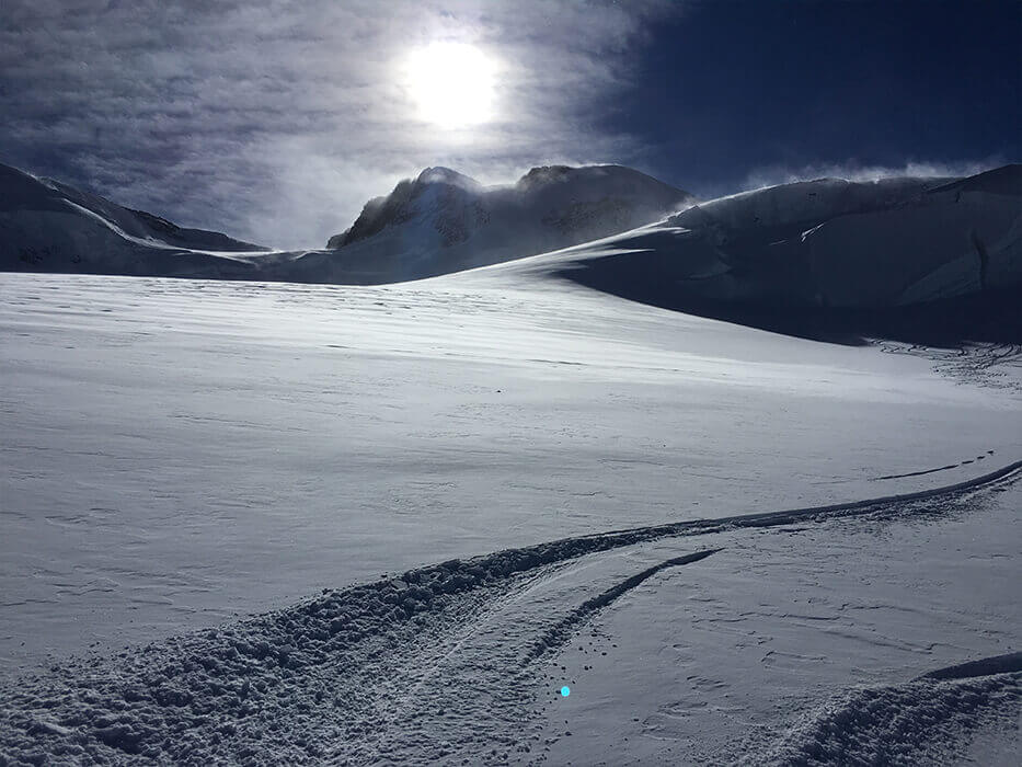
The great unknown factor of heliskiing in Cervinia is the wind, which often does not allow even access to Plateau Rosa by cable car, and unfortunately this is a problem that can arise even at the last minute.
The drop-off points above 3500m – Tete de Valpelline, Silbersattel, Lys and Verra – offer a unique opportunity to combine panoramas, long and exhilarating descents, and an Alpine setting. For enthusiasts, at least once in a lifetime, Cervinia is a must.
Silbersattel - Monte Rosa
Starting altitude: 4200m
Difference in altitude: 2350m
Difficulty: average, difficult for the glacier passages
Return: facilities
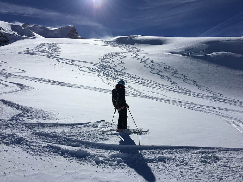
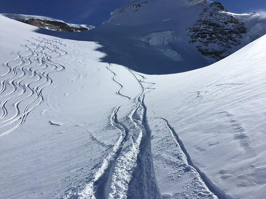
One of the most beautiful heliski descents of all, Silbersattel starts at 4200 metres under Monte Rosa, with a stupendous panorama and the Matterhorn in front of you.
The easiest – and cheapest – departure is from Plateau Rosa, Cervinia, at 3500 metres. The scenic flight lasts around ten minutes and is spectacular, because you pass over the Unter glacier, before veering to the right above Castore, Polluce and Lyskamm.
The descent is not very difficult, though certainly more challenging than others. Exposed to the west, it often has nice fresh snow and doesn’t give you that claustrophobic feeling you can have beneath Mont Blanc or in the smaller valleys of the Aosta Valley.
If you wish, you can take a break along the way at the Monte Rosa Hutte, a futuristic mountain refuge that Swiss people use during their climbs towards Monte Rosa.
The route then continues along the glacier between the crevasses and some obligatory tracts, arriving at a long plateau surrounded by the Monte Rosa massif in front, the Italian ridge on the right, Gornergrat on the left, and of course, the Matterhorn behind you.
The descent then joins the Unter Theodul off-piste descent, which starts from Cervinia, and approaches the so-called “Canyon”, a very narrow and picturesque passage where you slalom down like a bobsleigh track.
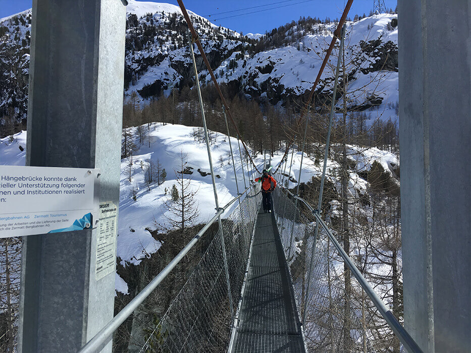
One last surprise: crossing the Tibetan bridge, which allows you to rejoin the Zermatt pistes, with your skis on your shoulder. You walk across a lovely rope bridge about 50 metres high: incredible and absolutely risk-free.
In Furi you can eat in the little Portuguese-run restaurant: classic Swiss cuisine, but fully in keeping with the setting and with that little Latin touch in the welcome that is always nice to find.
To get back to Cervinia it is best to be in Furi by 3-3.15 pm, otherwise you risk finding the skilift facilities closed.
Tete de Valpelline
Starting altitude: 3850m
Difference in altitude: 2000m
Difficulty: average, difficult for the glacier passages
Return: facilities
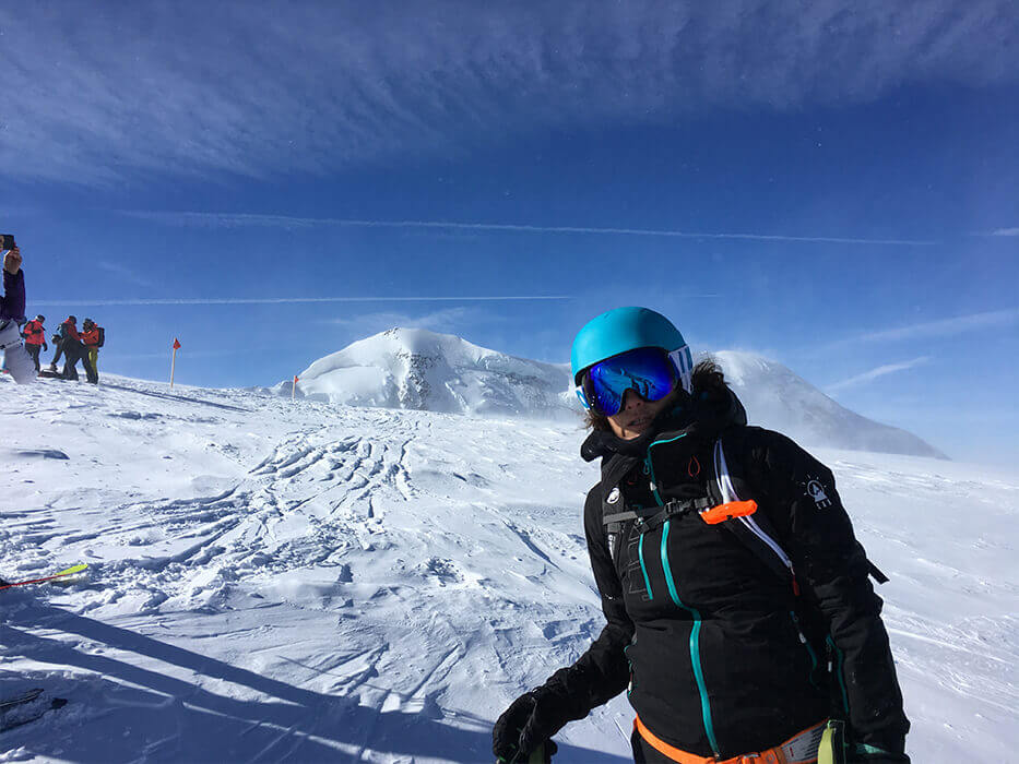
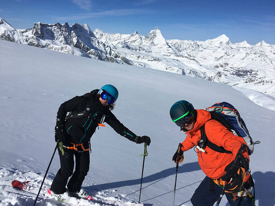
Looking upwards from the village, Tete de Valpelline is the mountain to the left of the Matterhorn and is 3850 metres high. The approach flight to the summit offers unique scenery: the vista of peaks and glaciers, the Matterhorn, and Dent d’Hereins.
The drop-off on Tete is breathtaking: you have a 360° view of the valleys around, the Valpelline glacier and the lesser-known Swiss mountains that envelop the valley.
The descent is quite long, alternating walls of average difficulty and rather flat stretches.
The second part is very easy; it is mainly quite level so ideal for looking around you and savouring the unforgettable scene.
This descent is so beautiful and satisfying that it can easily be the sole rotation in a day of heliskiing: after the off-piste run you can ski for a few more hours in the Zermatt area.
Verra Glacier
Starting altitude: 3900m
Difference in altitude: 1400m
Difficulty: average
Return: helicopter – car
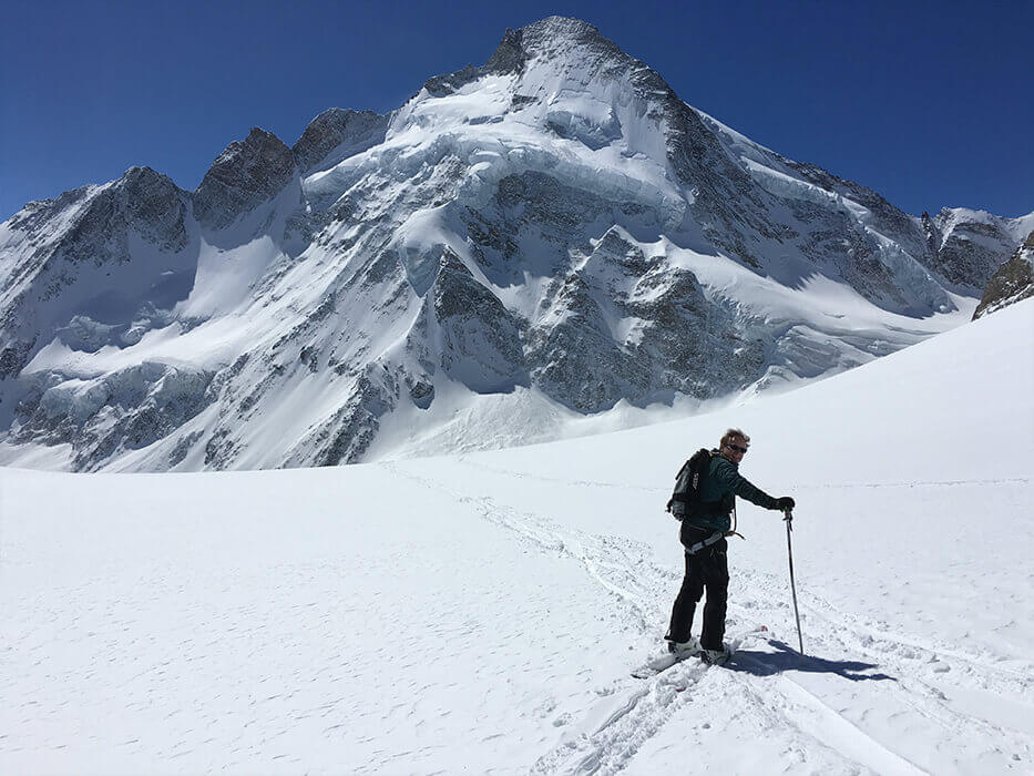
High-altitude drop-offs are one of the features that make heliskiing spectacular in the Aosta Valley and they allow runs of well over 1000 metres of difference in altitude. The landing pitch here is a spectacle in itself, lying between Castore and Polluce, having flown beside the Breithorn and the other 4000 metre-peaks in the area.
The descent on the glacier is often on powder snow in the upper part and is very enjoyable. There are lots of crevasses, at times not very visible, so you must ski slowly and extremely carefully. The panorama is unique and the slopes are great fun; on the left as you go down you will see two refuges that are well known in the valley: Guide d’Ayas, but especially Mezzalama, which is famous for giving its name to the gruelling ski-mountaineering competition that takes places there every year.
The second part of the descent is exposed to the south and in late season the snow is all transformed and very easy to ski. Overall, it is considered one of the finest descents in the district, because it combines a fine gradient with fabulous panoramas, and alone it can almost fill a whole day’s heliskiing.
Depending on the snow conditions, you may be able to stop at Piani di Verra (2500m), then descend as far as Lake Bleu (2200m), or press on to the facilities at Champoluc Frachey, which, however, are not connected to Cervinia, so you will have to return home by car or have the helicopter pick you up for another run.
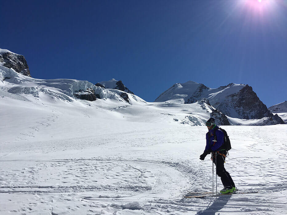
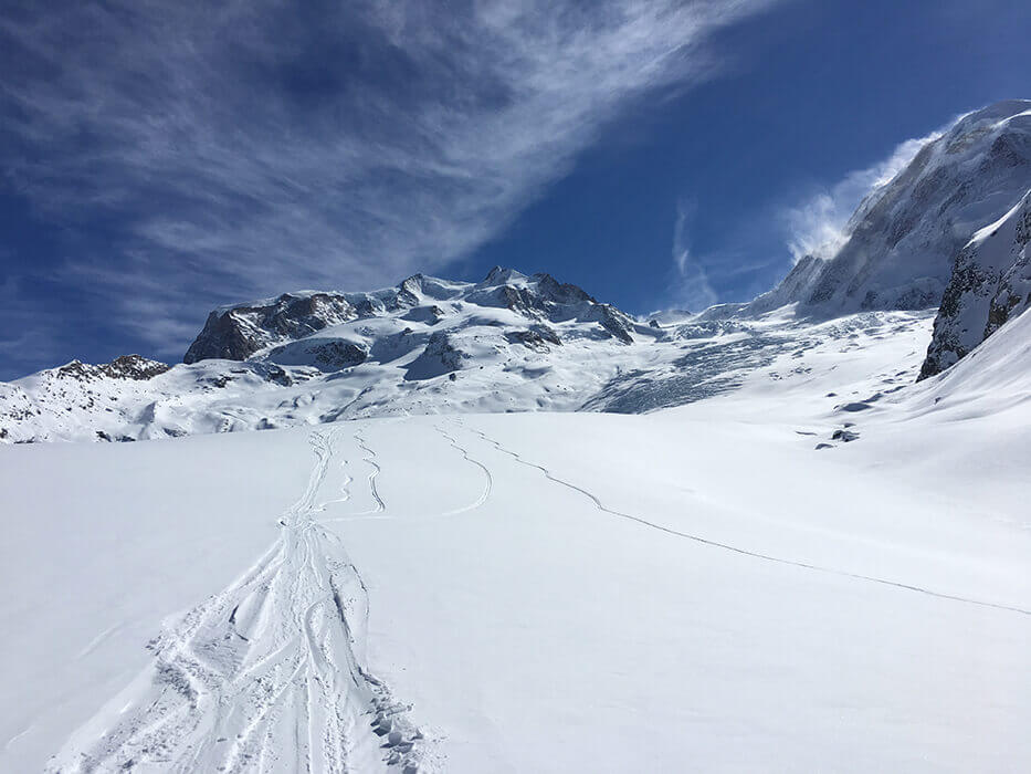
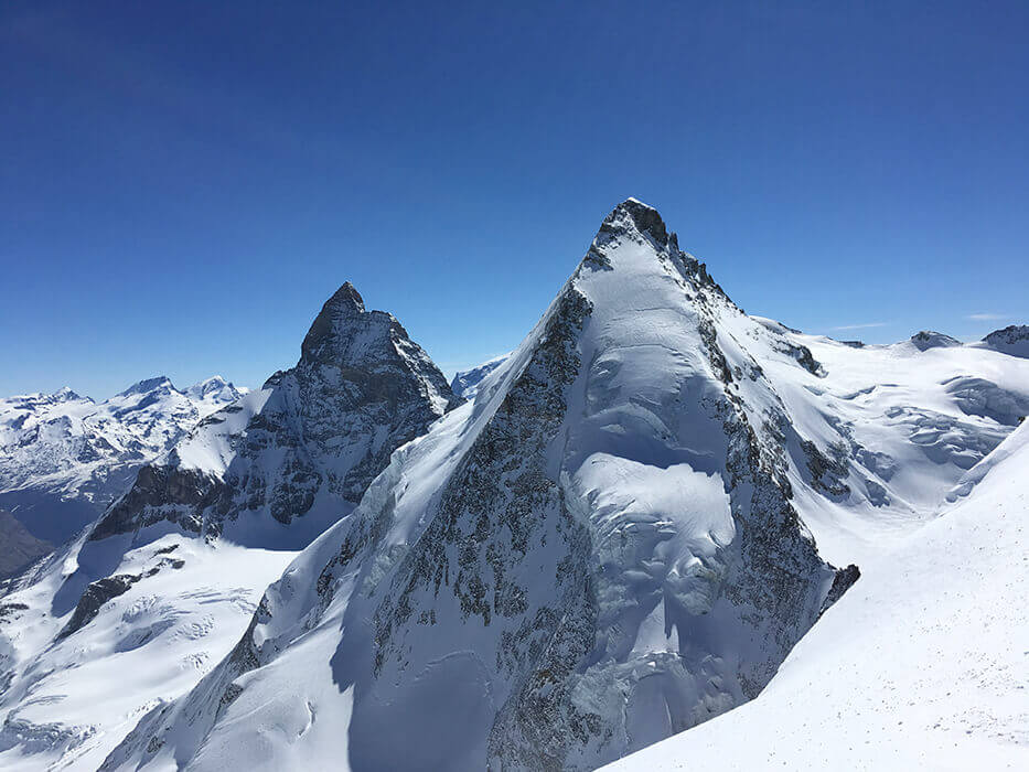
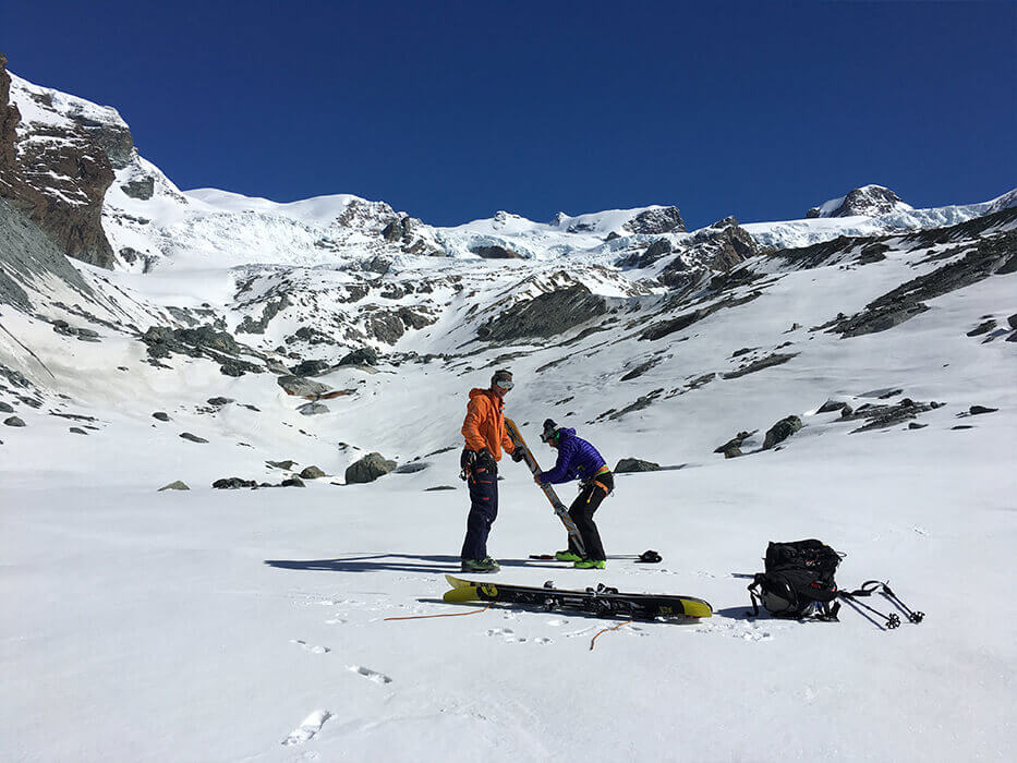
Some photos of the itineraries in Cervinia


Recap of Cervinia Heliski trails
| Name | Altitude difference | Glacier | Difficulty | Tweet judgement | Return/ Pick-up |
|---|---|---|---|---|---|
| Silbersattel 4200m | 2350m | YES | Average Difficult for passages on the glacier | The drop-off under Monte Rosa at 4200 metres is unforgettable, the start of a very long descent to Zermatt: glacier and fabulous scenery. Challenging, but accessible to almost everybody. | Furi, Zermatt facilities |
| Tete de Valpelline 3850m | 2000m | YES | Average Difficult for passages on the glacier | Total immersion in the mountain and silence with the Matterhorn looming. Nice walls, albeit requiring care, but the scenery is magnificent; you need training and a bit of skill. | Furi, Zermatt facilities |
| Verra Glacier 3910m | 1400m | YES | Average Difficult for passages on the glacier | The high-altitude drop-off between Castore and Polluce is thrilling. From here begins a spectacular descent on the glacier to Piani di Verra overlooking Champoluc valley and surrounded by mountains. On your left is the famous Mezzalama refuge. | Helicopter pick-up at Piani di Verra (2500m) or descend to Champoluc |
| Chateau des dames 3200m | 1300m | NO | Media | The north-facing slope promises a fun downhill even late in the season, as you often find powdery conditions. It is possible to choose trails of varying difficulties. | Helicopter pick-up at the trout lake |